Getting Here
Wondering how to get to Gunung Puntang in Bandung, Indonesia? Taman Wisata Bougenville helps you find the best way to get to Gunung Puntang with step-by-step directions from the nearest public transit station.
Taman Wisata Bougenville provides free maps and live directions to help you navigate through your city. View schedules, routes, timetables, and find out how long does it take to get to Gunung Puntang in real time.
Looking for the nearest stop or station to Gunung Puntang? Check out this list of stops closest to your destination: Jalan Raya Soreang - Banjaran 95.
You can get to Gunung Puntang by Bus. These are the lines and routes that have stops nearby -
Bus: SOREANG-BANJARAN
Want to see if there’s another route that gets you there at an earlier time? Taman Wisata Bougenville helps you find alternative routes or times. Get directions from and directions to Gunung Puntang easily from the Taman Wisata Bougenville App or Website.
We make riding to Gunung Puntang easy, which is why over 460 million users, including users in Bandung, trust Taman Wisata Bougenville as the best app for public transit. You don’t need to download an individual bus app or train app, Moovit is your all-in-one transit app that helps you find the best bus time or train time available.
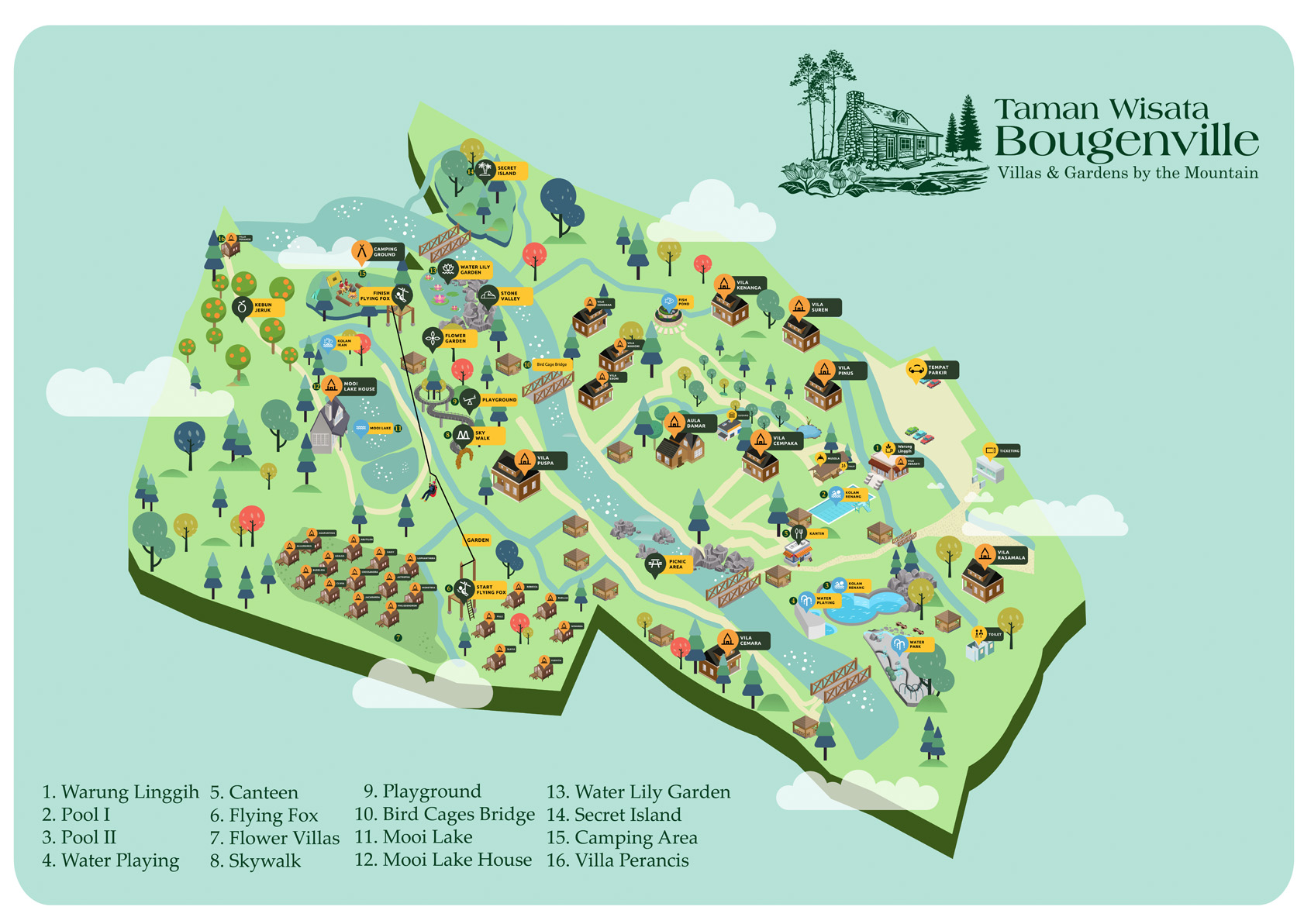
Taman Wisata Bougenville's Map